
Visiting the Lost Coast
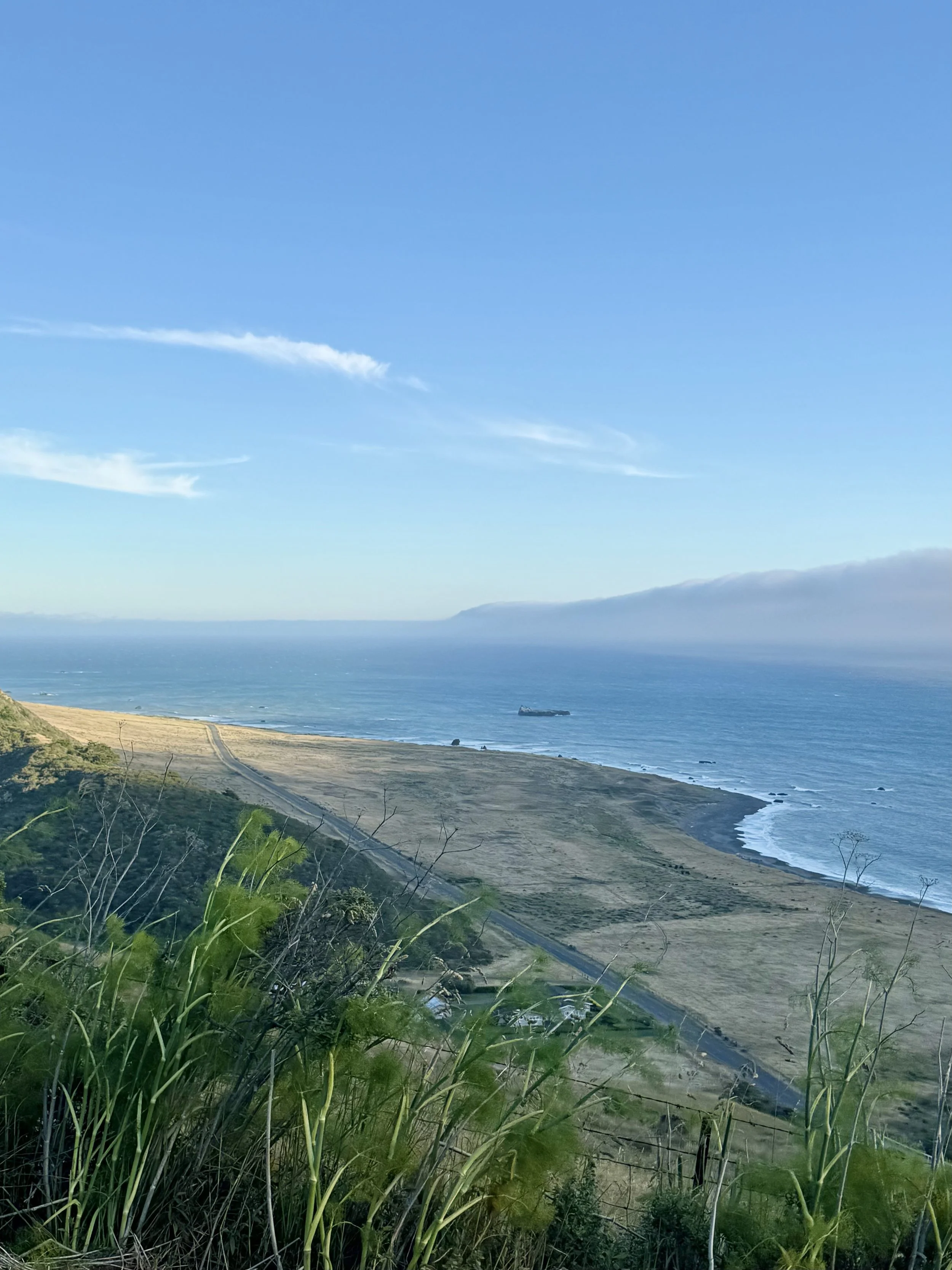
Our sanctuary sits in the middle of the beautiful Mattole Valley. Coming in thru the Rockefeller Redwood Forest and going out along a long stretch of the Pacific Coast. Located on the last stretch of California coastline too rugged for anyone to ever pave a highway through it. That's not an accident of geography we take lightly — it's the reason the horses have found healing and quiet here, and it's the reason our guests do too. Below is our guide to the wild, earthy, elevated country around us: on foot, on two wheels, and on four.
The Lost Coast Trail is the reason most people first hear our region's name. It runs roughly 24.6 miles along undeveloped shoreline between Mattole Beach — our stretch — and Black Sands Beach at Shelter Cove to the south, through the King Range National Conservation Area. Plan on at least three days if you're through-hiking it; the trail is mostly level, but three sections are impassable at high tide, so a tide table is non-negotiable, not optional.
The King Range itself rises straight out of the surf — King Peak climbs to about 4,088 feet only three miles from the ocean — and holds over 80 miles of trails beyond the coastal route, from beach-level tide pools to Douglas-fir ridgelines. Overnight camping on the Lost Coast Trail requires a backcountry permit through Recreation.gov; day use does not.
Day Hikes are amazing. We love hiking out and seeing the elephant seals near the Punta Gorda lighthouse.
You can explore old growth woods, tide pools thick with starfish and anemone, wildflower-covered bluffs in spring, and close to 300 recorded bird species. Bears, bobcats, mountain lions and Roosevelt elk are common enough that we mention them.
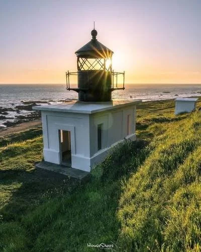
On the Trail: Lost Coast Trail & King Range
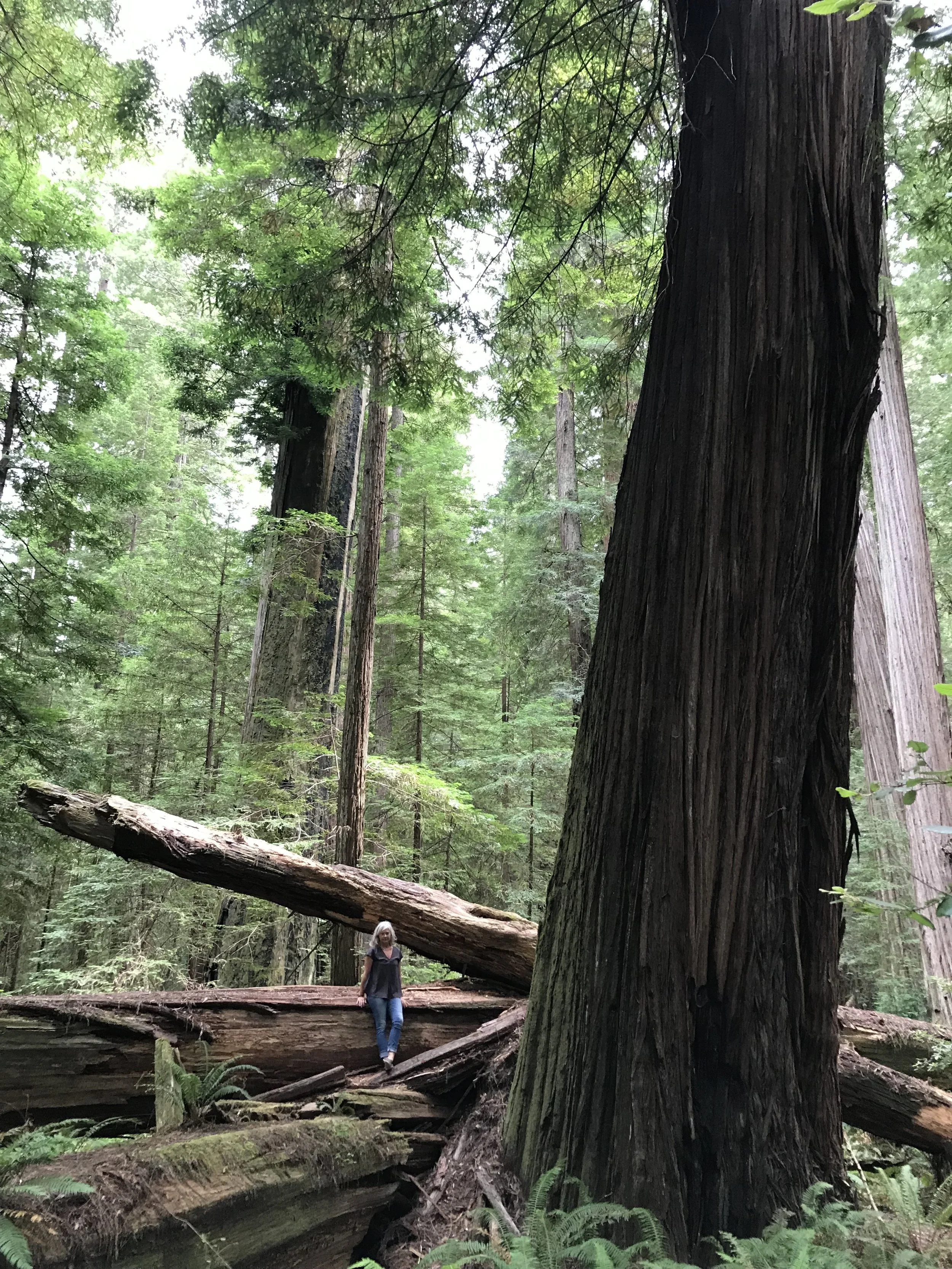
Humboldt Redwoods State Park & Avenue of the Giants
Home to Rockefeller Forest, the largest old-growth coast redwood forest remaining in the world, plus the Bull Creek Loop and Founders Grove. Cool and magical forest offering lots of hiking trails.
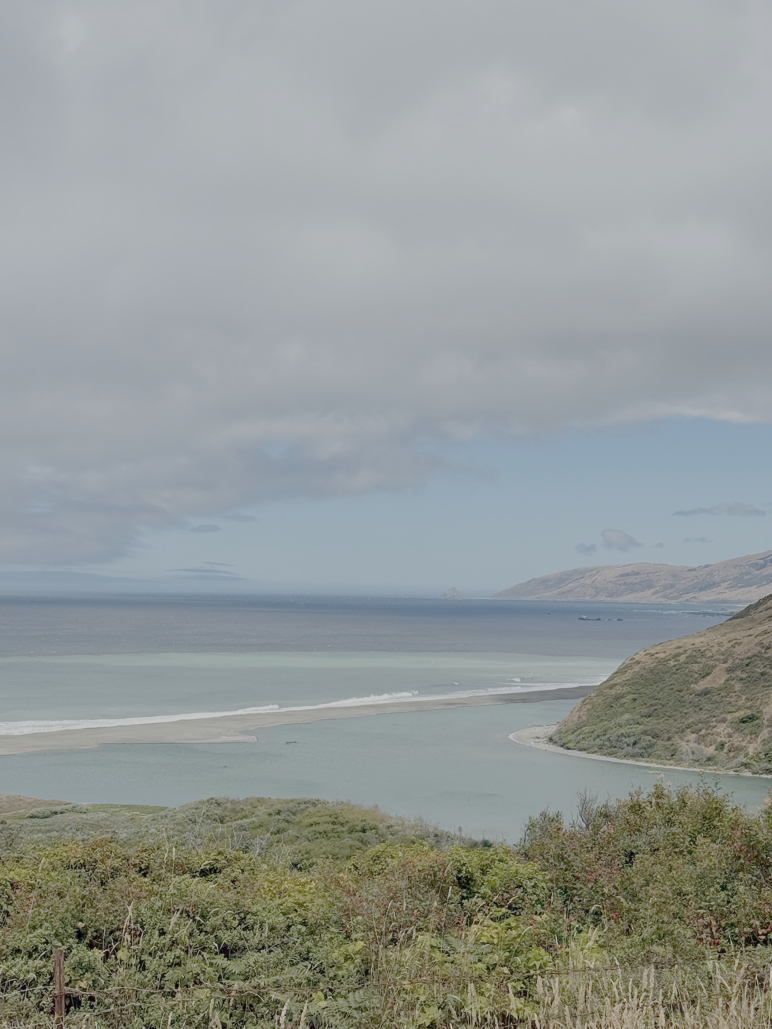
This is our front yard, more or less — the northern gateway to the Lost Coast Trail, reached by following Lighthouse Road west out of Petrolia. It's a working beach as much as a scenic one: the trailhead, a small BLM campground, grassy bluffs that give way to sand within the first mile heading south. From here, a flatter out-and-back walk of roughly three miles each way brings guests to the abandoned Punta Gorda Lighthouse, built in 1912 and decommissioned in 1951 — an easier taste of the Lost Coast for anyone not up for a multi-day trek.
Here you will also find the Mouth of the Mattole River and estuary.
Mattole Beach
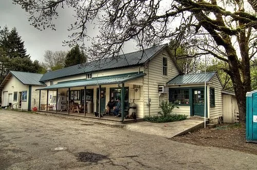
Honeydew - coming from the 101 Highway thru the Redwood forest you will arrive at this junction — the Honeydew Country Store. It's the last fuel and food stop for cyclists and motorcyclists heading into the King Range interior, and a natural hinge point if guests want to loop into the valley and head north toward Petrolia, 7-mile coastline + beaches, and out to Ferndale and the 101.
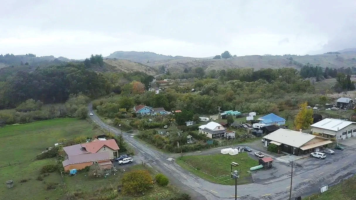
Petrolia - Ten minutes up the road, Petrolia is small — under 500 residents — but it carries real history: it's the site of California's first commercial oil well, which is where the town's name comes from. Today it's mostly a general store, a gas pump, and a handful of houses, but it's the last reliable supply point before the wilderness closes in, and it's worth a stop for anyone gassing up or grabbing provisions before heading out to the beach or onto the trail. Store (including gas pump) is open daily 9a-5p, but check in for shorter winter season hours.
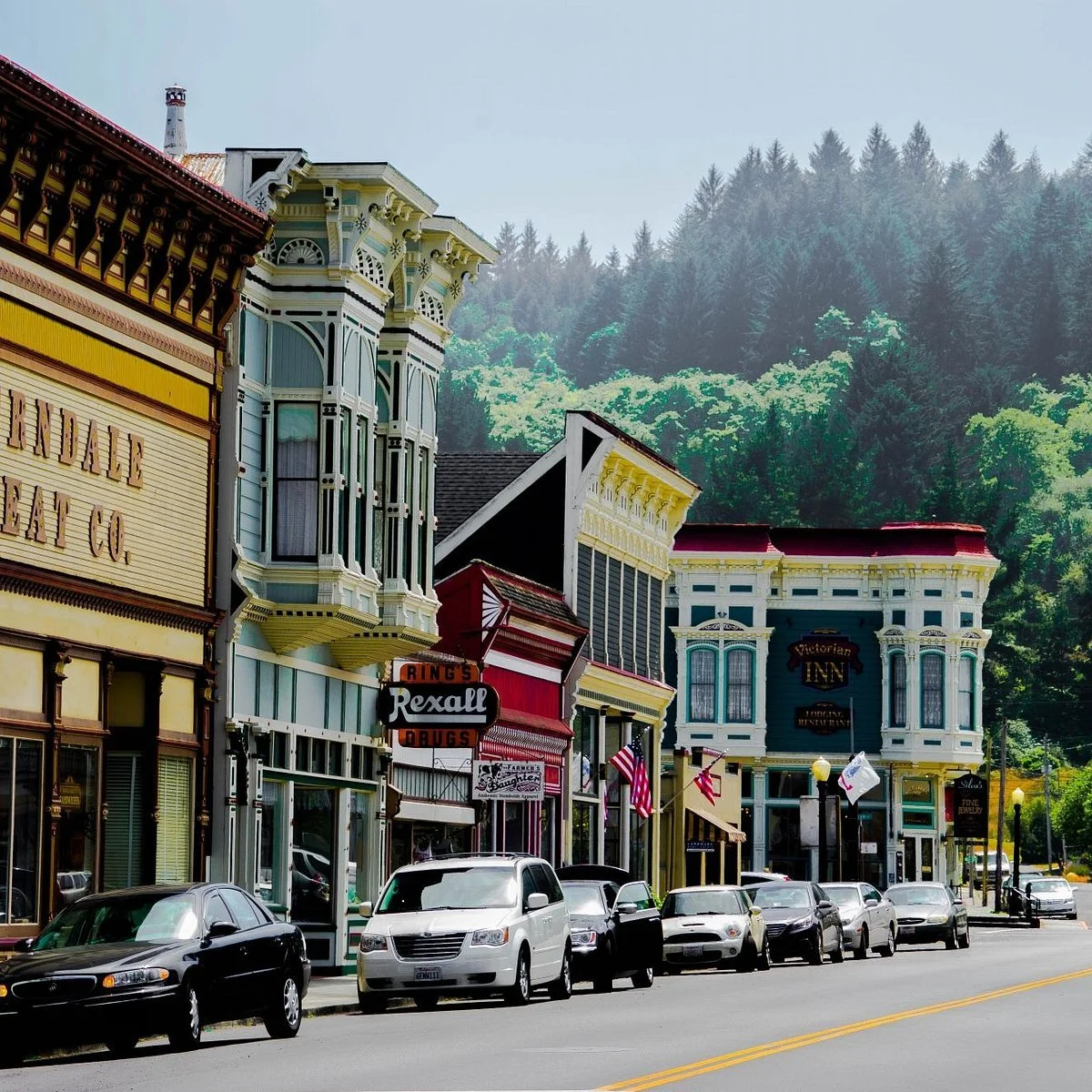
Ferndale - About a 45–60 minute drive from Petrolia (roughly 30 miles via the Mattole Road coastal route through Capetown, or a bit longer via 101), Ferndale is the Victorian counterpoint to our wilder end of the county — a working dairy town since the 1850s, its entire Main Street on the National Register of Historic Places. Coffee shops, shopping, and the old saloon make it a good half-day trip for guests who want a change of pace from the coast.
Small Towns
Two Wheels: The Lost Coast BDR-X
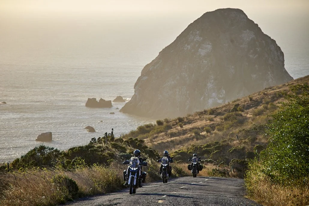
For adventure motorcyclists, the Lost Coast California BDR-X is a roughly 500-mile figure-eight loop out of Fort Bragg, and it runs right through our front door — down Mattole Road through Petrolia, past Kinsey Ridge and the Honeydew Store, with an optional technical spur out to Punta Gorda via Lighthouse Road. Riders should expect primitive dirt roads, a seasonal bridge (typically open mid-June through October), and steep grades that turn treacherous when wet. Fuel is available in Petrolia, Honeydew, and Rio Dell.
Even for riders not doing the full BDR, Mattole Road itself has a reputation — it's been called one of the best adventure drives in the country and "a must-do road for many motorcyclists," a 66-mile loop with only one paved intersection (Wilder Ridge Road) the whole way.
Pedal Power: Cycling the Lost Coast
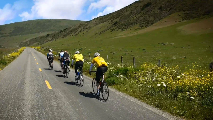
Mattole Road is also a serious cycling destination, usually ridden from Ferndale south — about 75 miles and roughly 9,000 feet of climbing if a rider takes it all the way through to the Avenue of the Giants. It's steep, remote, and largely unshouldered, which is part of the appeal for cyclists looking for solitude after busier coastal routes.
Bikepackers also tackle Wilder Ridge Road and King Peak Road into the King Range interior — steep, occasionally 19% grade, mixed pavement and gravel — with Honeydew as the last resupply point before the climb.
Things to Know:
The Lost Coast earned its name honestly. Here's what our guests should know before they head out from the sanctuary, on foot or behind the wheel.
Gas and supplies close early — plan around it, not around them. There are exactly two gas pumps between Ferndale and Highway 101 to the south: one in Petrolia, one in Honeydew. Both are attached to small general stores, and both keep limited hours — nothing here is open late or overnight. If a guest's tank is under half full, or it's evening, we tell them to fill up before the stores close rather than count on a next stop. There isn't one.
Cell service is not a given — treat it as absent. Coverage along Mattole Road and throughout the King Range is spotty at best and, in most stretches, nonexistent. Multiple sources describe entire 20-mile sections with no service and no other travelers. Guests should download offline maps in advance, tell someone their route and expected return time, and not count on being reachable — or able to reach anyone — once they leave the highway.
The roads are narrow, unpaved in sections, and locally nicknamed for a reason. Mattole Road coming from Ferndale is known to everyone around here as "the Wildcat" — a narrow, winding, roughly 35-mile route between Ferndale and Petrolia with steep grades (one stretch out of Cape Mendocino, "the Wall," runs an 18% grade for a full mile), sharp switchbacks, unfenced ranch land where livestock can be in the road, and sections that narrow to one lane. It's mostly paved but not entirely, with patches of gravel, washouts, and potholes that reappear every rainy season. It is not a recommended route for large RVs, and it is best avoided at night or when there is dense fog, especially when its heavily raining as the risk of slides and washouts rises. Winter travel over the higher sections can mean occassional snow and might require chains.
Tides and ocean conditions on the Lost Coast Trail are not optional planning — they're the whole plan. Three sections of the trail are impassable at high tide, and hikers have died in these tidal zones; if swept in, hypothermia sets in within roughly 20 minutes. Never swim, wade, or wait out a wave in the ocean anywhere along this coast — sneaker waves, rip currents, and strong undertow are real and well-documented hazards, even on calm-looking days. A current tide table isn't a nice-to-have here, it's required gear.
This is bear, rattlesnake, tick, and poison-oak country. Black bears are present, and hard-sided bear canisters are required for all overnight food storage if camping. Rattlesnakes turn up in grassy terraces and driftwood piles, especially spring through summer. Ticks are common in overgrown and grassy sections; guests should check themselves after hiking. Poison oak grows throughout the region in every form — vines, bushes, even small plants in the sand — so knowing what it looks like matters.
Help is genuinely far away. The Petrolia Volunteer Fire Department's own coverage notes put the nearest mutual aid for fire and medical emergencies at about 35 minutes out under good conditions, with outside engines taking 45 minutes to an hour and a half depending on weather and road conditions. The BLM does not run a search-and-rescue team on the Lost Coast Trail — hikers are expected to be able to self-extricate, and a satellite communicator (like an InReach) is strongly recommended for backcountry trips. In a true emergency, always call 911 first — but guests should understand that "far away" is not an exaggeration out here.
This is also seismically active ground. The region sits in one of California's most active earthquake zones, and tsunami warning signs and evacuation routes are posted along the coast for a reason. If a guest feels a strong quake while on the beach, the guidance is simple: move to high ground immediately.